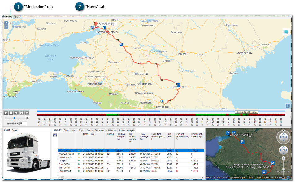
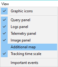
Main map – by default, Google Earth map is displayed in the panel (see the section Toolbar).
Additional map – by default, OpenStreetMap and 2GIS are displayed in the panel (see the sectionToolbar).
There is a possibility to change the size of the panel. To do this, move the mouse to the edge of the panel, and when you see the arrow/ , drag the edge to set the size of the panel.
When you use the optionChange map, the map set as the main one will be set as the additional map, and the map currently used as the additional map, will become the main map.
When this option is activated, Additional map is automatically centered to a point that corresponds to the point in the center of the Main map.
When this option is activated, names of all objects selected with a tick in the vehicle fleet structure are indicated on the map. The name indicated on the map corresponds to the name of this object in the vehicle fleet structure.
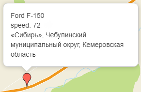
When this option is activated and object selected in the vehicle fleet structure with the mouse cursor, then a window with additional information for this object (object name, speed and current location) appears on the map (OpenStreetMap and 2GIS):
To make monitoring more convenient, 3 kinds of maps are used in the system (Google Earth – satellite images, OpenStreetMap and 2GIS – vector maps). On these maps, markers of objects, tracks (see the settings in the section Settings - General) and event locations are displayed.
You can work with Google Earth map using navigation tools that are located in the upper right corner of the map screen.
You can also use your mouse to change the map scale, to rotate the map about the X and the Y axis and to move the map to any direction.
When pressed, the middle button of the mouse (the wheel) can rotate and angle the map, the left button of the mouse helps to move the map, the right button (depending on the mouse movement) zooms the map in/out; double click on the left button of the mouse helps you to draw the map closer, and double click on the right button of the mouse helps to distance the map.
The News tab displays a page of the company's website. On this page, you can find information about latest changes/updates of the system and other useful information.